
Showing posts with label Historical Maps. Show all posts
Showing posts with label Historical Maps. Show all posts
Sunday, March 13, 2011
A Newly Scanned French Map from 1546 shows Australia


Thursday, July 15, 2010
Sunday, July 01, 2007
Early Plans for Administration of Australia

From Strange Maps
The Commonwealth of Australia was formed in 1901. Its constitution provides for the creation of new states, also by subdividing extisting ones. Several proposals have been made to alter Australia’s composition, yet no change has been made since the act of Federation in 1901: Australia still consists of 6 states and two mainland territories (Northern and Capital).
This map, dated 1838, shows an earlier proposal for the subdivision of Australia into 10 states. It was published by the Journal of the Royal Geographical Society in London, and accompanied an article entitled Considerations on the Political Geography and Geographical Nomenclature of Australia. In it, the following divisions were proposed:
• Dampieria: North-western Australia
• Victoria: South-western Australia (far from the present-day state in the South-east)
• Tasmania: part of present-day Western Australia and Northern Territory (not the present-day island/state)
• Nuytsland: near the Nullarbor Plain
• Carpentaria: south of the Gulf of Carpentaria
• Torresia: Northern Queensland
• Cooksland: near Brisbane, in New South Wales and Queensland
• Guelphia: present-day Victoria, most of New South Wales, part of Southern Australia
• Van Diemen’s Land: what is now Tasmania
• Flindersland: what is now most of South Austalia
That strange blob of land south of the Victoria/Nuytsland coast? That’s Portugal and Spain, lifted from their spot between the Atlantic and the Mediterranean, twisted around and dropped here, for size comparison purposes.
Map found here on Wikipedia.
I would now be living in Flindersland.
Thursday, November 30, 2006
The Kingdom of Fife

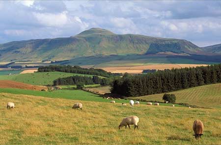 Just a couple of images from where I grew up. I like old maps. This is from 1659. Below is East Lomond an eroding volcanic lump close to Auchtermuchty (Home of the Proclaimers). We used to go walking there fairly regularly, just up the road from Falkland , home of the oldest tennis court in Scotland. They still use it now to play real tennis.
Subscribe to:
Posts (Atom)